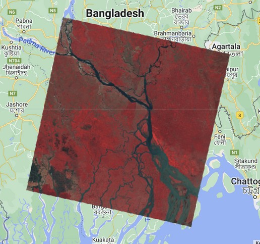
Clip Image by Feature/FeatureCollections in Google Earth Engine
Earth engine is a powerful platform to deal with massive scale earth observation datasets. Clip is one of the useful functions in Google Earth Engine that use to clip raster image or image collections for a specific area as feature or feature collection.

- by Kamal Hosen
- Sep 12, 2023
How to Composite and Mosaic Images in Google Earth Engine?
The way of composite and mosaic of satellite images or image collection to create a single image in Google Earth Engine
- by Kamal Hosen
- Sep 12, 2023
How to Create a Point/Polygon Features in Earth Engine?
In Earth Engine, features can be created by geometry using the ee.Geometry() function. The ee.Geometry() function allows you to create various types of geometries such as points, lines, polygons, rectangles, and circles.
- by Kamal Hosen
- Apr 09, 2023
How to Count Total Number of Features in Vector Data in Earth Engine?
In Earth Engine, the number of features in a FeatureCollection can be obtained using the .size() method. Here, we will count the number of total features in the TIGER states feature collection.
- by Kamal Hosen
- Apr 09, 2023
Metadata - Get Details about Vector Data in Earth Engine
Metadata is an important data for understanding the data in details. Earth Engine provide ee.Feature class to access the metadata for vector data.
- by Kamal Hosen
- Apr 08, 2023
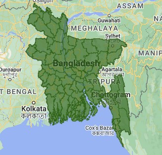
How to Import and Visualize Vector Data in Google Earth Engine?
FeatureCollection is an accumulation of features to enable additional operations such as filtering, sorting and rendering. Earth Engine store the vector data as table and import as FeatureCollection.
- by Kamal Hosen
- Oct 31, 2022
How to Upload Shapefile/GeoJSON data in Google Earth Engine?
Google Earth Engine provides an option to upload a custom shapefile or geojson data from user.
- by Kamal Hosen
- Oct 31, 2022
Visualize Image in Google Earth Engine
We can visualize raw or process images in various ways at Google Earth Engine.
- by Kamal Hosen
- Oct 25, 2022
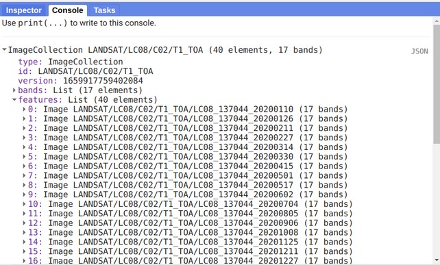
Exploring Image Collection and Image Metadata in Google Earth Engine
Image meta data is an import information to know more about the image like band names, projection information, properties, etc.
- by Kamal Hosen
- Aug 23, 2022
Basics of Filtering and Sorting Image Collection in Google Earth Engine
Google Earth Engine is providing a filtering and sorting function to reduce the number of images and getting a least cloudy images from an image collection
- by Kamal Hosen
- Aug 23, 2022
Google Earth Engine Image Collection - An Overview
Image collection is a way of grouping accumulated/collected timestamp images that have similar characteristics into a single location.
- by Kamal Hosen
- Aug 23, 2022
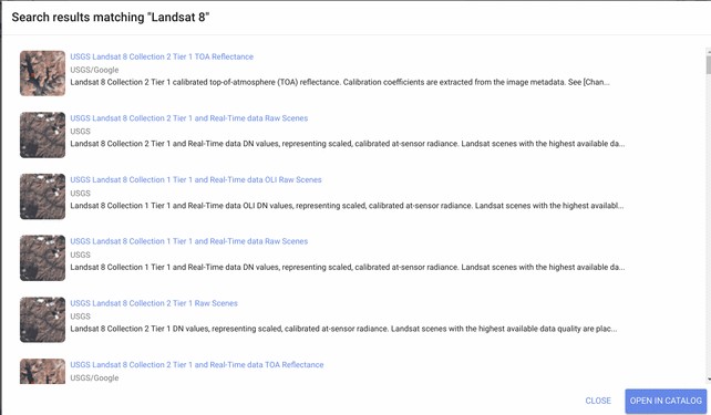
An Introduction to Earth Engine Data Catalog - List of Available Datasets
Google Earth Engine (GEE) hosts publicly available multi-petabyte curated geospatial datasets from various sources fostering geospatial analysis and overcoming the limitations of data storage and computational power.
- by Kamal Hosen
- Aug 23, 2022
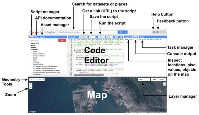
Google Earth Engine Code Editor – A Brief Discussions
Google Earth Engine provides an interactive web-based IDE to read, write, run code, debug, analyze and visualize data in an interactive way.
- by Kamal Hosen
- Aug 23, 2022
An Introduction to Google Earth Engine
Google Earth Engine (GEE) is a cloud-based platform that offers multi-level geospatial data analysis at planetary scale.
- by Kamal Hosen
- Aug 22, 2022