How to Upload Shapefile/GeoJSON data in Google Earth Engine?
Google Earth Engine provides an option to upload a custom shapefile or geojson data from the user.
In this tutorial, I will show you how to upload our custom shapefile or geojson data to Google earth engine?
Step 1: Sign-in and Navigate to Google Earth Engine Code Editor
Visit https://earthengine.google.com/, and from the platform menu click on code editor. You will be redirected to https://code.earthengine.google.com/. Provide the necessary information to login and access to earth engine.
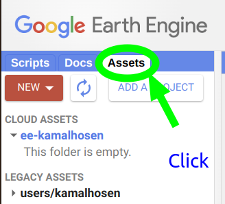
Step 2: Navigate to Asset Directory
In the left sidebar of earth-engine, click on asset.
3. Select File Type and Upload Data

Click on the New button, you will see the Image upload and Table upload options.
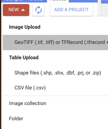
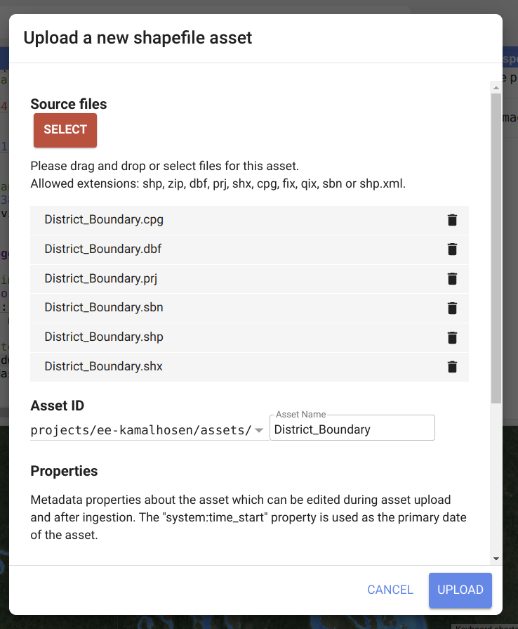
Click on the Shape files under Table Upload. You see an upload option. Again click on the select button and navigate to the data folder and select the shapefile and click on the upload button.
The upload status will show in the right-side task panel. After successfully uploaded, it will appear in the left sidebar, asset panel under the legacy asset folder.
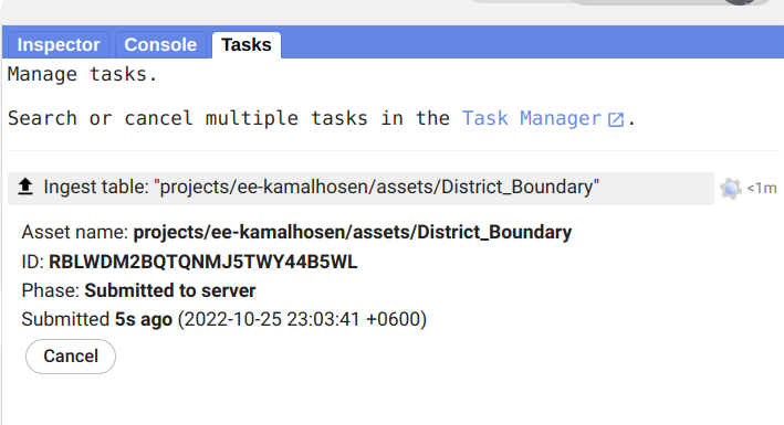
After completing the upload, the uploaded asset will appear in the asset tab of the left-side sidebar.

Share To
About Author
- Kamal Hosen
Geospatial Developer | Data Science | PythonA passionate geospatial developer and analyst whose core interest is developing geospatial products/services to support the decision-making process in climate change and disaster risk reduction, spatial planning process, natural resources management, and land management sectors. I love learning and working with open source technologies like Python, Django, LeafletJS, PostGIS, GeoServer, and Google Earth Engine.